-
Calculating the probability of earthquake ground shaking at the surface or in the bedrock beneath a site based on the location of surrounding faults with fast algorithms
-
Full access to graphical GIS objects
-
Multi GIS layer with different graphical information
-Deferent geo-referencing for every layer
-Using UTM & Lat-Lon coordinate for every layer
-
Using seismic source as area/line/background with 3d depth
-
Digitizer simulation with various background image
-
Reading and processing GIS shapefiles
-
Create seismic group involves:
-Magnitude of completeness/ Declustering/ Poisson distribution
-Recurrence function as One order single line/ N order multi-line/ Kijko–Sellevoll
-
Using spectral and nonspectral attenuation with string processing
-
Drawing GIS annotation & create perimeter information
-
Using automatic logic tree in five branches:
-Source shapes/Seismicity/Magnitude/Attenuation/Distance
-Perform manual logic tree with adding seismic layer
-
Operating site soil types
-
Deterministic/ Probabilistic within Spectral/ Nonspectral calculation
-
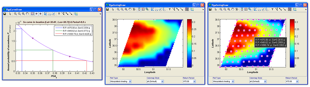
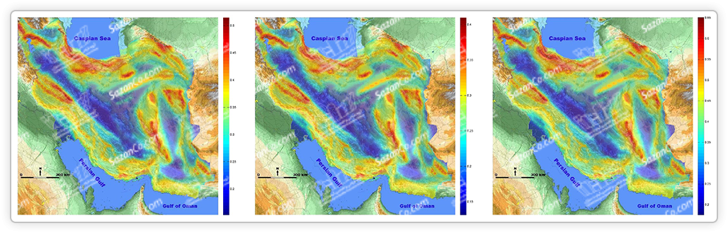
Hazard result as:
-Hazard curves/Hazard zoning/Zoning profile/Uniform hazard spectra
-Variety in contour type & graphical zoning
-Graphical/Text report maker
")